 vesseltracker.com
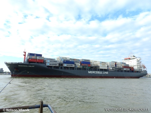
Vessel Mercosul Itajai IMO: 9697002, MMSI: 710027240 Container Ship
UTC, -33.19482, -52.26518, course: 33, speed: 16.7
UTC, -33.03333, -52.14431, course: 35, speed: 16.8
2026-01-20 05:36:00 UTC, -32.79500, -51.95667, course: -1, speed: 17
Live AIS position:
UTC. 45 nm S of Rio Grande),
updated 2026-01-20 05:36:00 UTC.
Find the position of the vessel Mercosul Itajai on the map. The latter are known coordinates and path.
marine traffic ship tracker show on live map
The current position of vessel Mercosul Itajai is -32.79500 lat / -51.95667 lng. Updated: 2026-01-20 05:36:00 UTCCurrently sailing under the flag of Brazil
Details:
Last coordinates of the vessel:
UTC, -33.54333, -52.50905, course: 36, speed: 16.9UTC, -33.19482, -52.26518, course: 33, speed: 16.7
UTC, -33.03333, -52.14431, course: 35, speed: 16.8
2026-01-20 05:36:00 UTC, -32.79500, -51.95667, course: -1, speed: 17