 vesseltracker.com
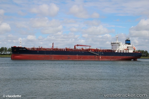
Vessel AGAPI 1 IMO: 9697210, MMSI: 249905000 Tanker
UTC, 51.88354, 4.44366, course: 252, speed: 0
UTC, 51.88360, 4.44369, course: 252, speed: 0
2026-02-26 03:47:12 UTC, 51.88357, 4.44368, course: -1, speed: 0
Live AIS position:
UTC. Near ROTTERDAM WAALHAVEN),
updated 2026-02-26 03:47:12 UTC.
Find the position of the vessel AGAPI 1 on the map. The latter are known coordinates and path.
marine traffic ship tracker show on live map
The current position of vessel AGAPI 1 is 51.88357 lat / 4.44368 lng. Updated: 2026-02-26 03:47:12 UTCCurrently sailing under the flag of Malta
Details:
Last coordinates of the vessel:
UTC, 51.88355, 4.44369, course: 252, speed: 0UTC, 51.88354, 4.44366, course: 252, speed: 0
UTC, 51.88360, 4.44369, course: 252, speed: 0
2026-02-26 03:47:12 UTC, 51.88357, 4.44368, course: -1, speed: 0