 vesseltracker.com
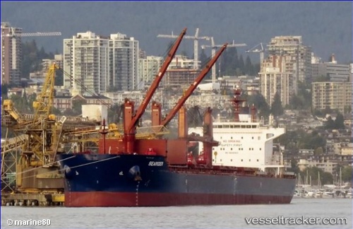
Vessel Searider IMO: 9698953, MMSI: 256427000 Bulk Carrier
UTC, 54.92387, 5.26576, course: 202, speed: 11.3
UTC, 54.65333, 5.01167, course: -1, speed: 11
2026-02-19 05:35:55 UTC, 54.25888, 4.64551, course: 206, speed: 11.2
Live AIS position:
UTC. 50 nm NE of Neeltje Jans),
updated 2026-02-19 05:35:55 UTC.
Find the position of the vessel Searider on the map. The latter are known coordinates and path.
marine traffic ship tracker show on live map
The current position of vessel Searider is 54.25888 lat / 4.64551 lng. Updated: 2026-02-19 05:35:55 UTCCurrently sailing under the flag of Malta
Details:
Last coordinates of the vessel:
UTC, 55.23895, 5.57869, course: 209, speed: 11.7UTC, 54.92387, 5.26576, course: 202, speed: 11.3
UTC, 54.65333, 5.01167, course: -1, speed: 11
2026-02-19 05:35:55 UTC, 54.25888, 4.64551, course: 206, speed: 11.2