 vesseltracker.com
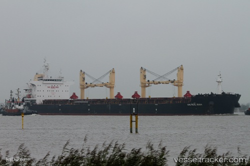
Vessel PAN HARVEST IMO: 9699335, MMSI: 352001184 Bulk Carrier
UTC, 27.58105, -36.04563, course: 267, speed: 10.9
UTC, 27.54241, -36.69063, course: 269, speed: 10.5
2026-02-01 18:15:57 UTC, 27.51995, -37.18225, course: 267, speed: 11.5
Live AIS position:
UTC. 285 nm SW of Sde Uziyahu),
updated 2026-02-01 18:15:57 UTC.
Find the position of the vessel PAN HARVEST on the map. The latter are known coordinates and path.
marine traffic ship tracker show on live map
The current position of vessel PAN HARVEST is 27.51995 lat / -37.18225 lng. Updated: 2026-02-01 18:15:57 UTCCurrently sailing under the flag of Panama
PAN HARVEST built in 2015 year
Deadweight:
63577 tDetails:
Last coordinates of the vessel:
UTC, 27.59339, -35.75906, course: 268, speed: 10.8UTC, 27.58105, -36.04563, course: 267, speed: 10.9
UTC, 27.54241, -36.69063, course: 269, speed: 10.5
2026-02-01 18:15:57 UTC, 27.51995, -37.18225, course: 267, speed: 11.5