 vesseltracker.com
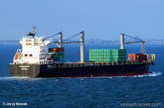
Vessel QUEEN ESTHER IMO: 9700251, MMSI: 636021198 Container Ship
UTC, 1.26787, 103.76859, course: 287, speed: 4.1
2026-02-04 10:59:31 UTC, 1.26787, 103.76859, course: 287, speed: 4.1
Live AIS position:
UTC. Near Pasir Panjang Wharves),
updated 2026-02-04 10:59:31 UTC.
Find the position of the vessel QUEEN ESTHER on the map. The latter are known coordinates and path.
marine traffic ship tracker show on live map
The current position of vessel QUEEN ESTHER is 1.26787 lat / 103.76859 lng. Updated: 2026-02-04 10:59:31 UTCCurrently sailing under the flag of Liberia
QUEEN ESTHER built in 2016 year
Deadweight:
25000 tDetails:
Last coordinates of the vessel:
UTC, 1.26787, 103.76859, course: 287, speed: 4.1UTC, 1.26787, 103.76859, course: 287, speed: 4.1
2026-02-04 10:59:31 UTC, 1.26787, 103.76859, course: 287, speed: 4.1