 vesseltracker.com
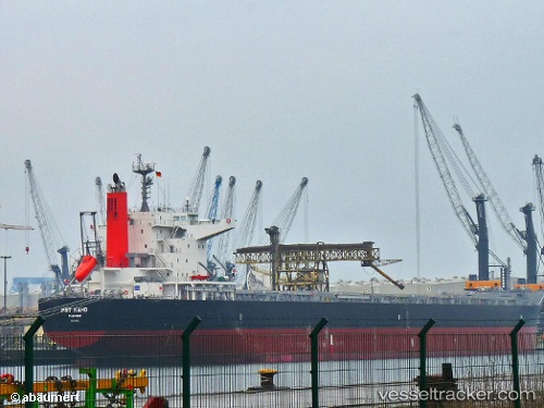
Vessel Prt Kaho IMO: 9701152, MMSI: 372348000 Bulk Carrier
UTC, 3.15630, -29.62139, course: 129, speed: 9.8
UTC, 2.91567, -29.37406, course: 132, speed: 9.2
2026-02-04 20:15:52 UTC, 2.64523, -29.09230, course: 133, speed: 10
Live AIS position:
UTC. 394 nm N of Aquiraz),
updated 2026-02-04 20:15:52 UTC.
Find the position of the vessel Prt Kaho on the map. The latter are known coordinates and path.
marine traffic ship tracker show on live map
The current position of vessel Prt Kaho is 2.64523 lat / -29.09230 lng. Updated: 2026-02-04 20:15:52 UTCDetails:
Last coordinates of the vessel:
UTC, 3.40350, -29.87576, course: 135, speed: 9.9UTC, 3.15630, -29.62139, course: 129, speed: 9.8
UTC, 2.91567, -29.37406, course: 132, speed: 9.2
2026-02-04 20:15:52 UTC, 2.64523, -29.09230, course: 133, speed: 10