 vesseltracker.com
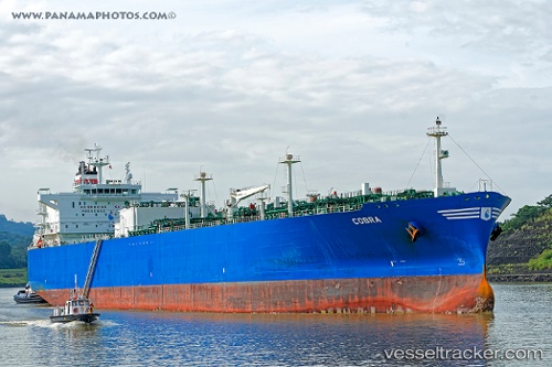
Vessel Cobra IMO: 9702015, MMSI: 311000345 Lpg Tanker
UTC, 40.72895, -57.82813, course: 87, speed: 12.3
UTC, 40.77818, -57.12181, course: 81, speed: 10.8
2026-02-19 20:31:46 UTC, 40.86805, -56.65851, course: 73, speed: 10.8
Live AIS position:
UTC. 167 nm NW of Jonesville),
updated 2026-02-19 20:31:46 UTC.
Find the position of the vessel Cobra on the map. The latter are known coordinates and path.
marine traffic ship tracker show on live map
The current position of vessel Cobra is 40.86805 lat / -56.65851 lng. Updated: 2026-02-19 20:31:46 UTCCurrently sailing under the flag of Bahamas
Details:
Last coordinates of the vessel:
UTC, 40.60833, -58.40167, course: -1, speed: 14UTC, 40.72895, -57.82813, course: 87, speed: 12.3
UTC, 40.77818, -57.12181, course: 81, speed: 10.8
2026-02-19 20:31:46 UTC, 40.86805, -56.65851, course: 73, speed: 10.8