 vesseltracker.com
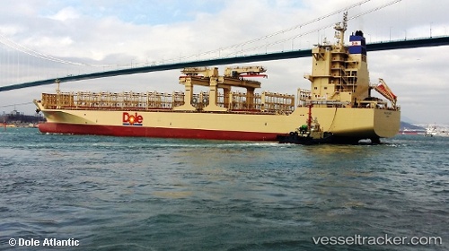
Vessel Dole Atlantic IMO: 9703069, MMSI: 311000415 Container Ship
UTC, 22.49328, -110.41662, course: 126, speed: 20.4
UTC, 21.78091, -109.28558, course: 123, speed: 21.5
2026-02-26 22:18:41 UTC, 21.32364, -108.56951, course: 121, speed: 21
Live AIS position:
UTC. 115 nm W of Nayarit),
updated 2026-02-26 22:18:41 UTC.
Find the position of the vessel Dole Atlantic on the map. The latter are known coordinates and path.
marine traffic ship tracker show on live map
The current position of vessel Dole Atlantic is 21.32364 lat / -108.56951 lng. Updated: 2026-02-26 22:18:41 UTCDetails:
Last coordinates of the vessel:
UTC, 22.92677, -111.10877, course: 124, speed: 20.1UTC, 22.49328, -110.41662, course: 126, speed: 20.4
UTC, 21.78091, -109.28558, course: 123, speed: 21.5
2026-02-26 22:18:41 UTC, 21.32364, -108.56951, course: 121, speed: 21