 vesseltracker.com
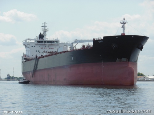
Vessel Ohio IMO: 9704776, MMSI: 338227000 Crude Oil Tanker
UTC, 60.68333, -151.39833, course: -1, speed: 0
UTC, 60.59797, -151.39848, course: 199, speed: 11.9
2026-02-18 23:25:16 UTC, 60.25841, -151.67188, course: 203, speed: 11.1
Live AIS position:
UTC. Near Clam Gulch),
updated 2026-02-18 23:25:16 UTC.
Find the position of the vessel Ohio on the map. The latter are known coordinates and path.
marine traffic ship tracker show on live map
The current position of vessel Ohio is 60.25841 lat / -151.67188 lng. Updated: 2026-02-18 23:25:16 UTCCurrently sailing under the flag of USA
Details:
Last coordinates of the vessel:
UTC, 60.68333, -151.39833, course: -1, speed: 0UTC, 60.68333, -151.39833, course: -1, speed: 0
UTC, 60.59797, -151.39848, course: 199, speed: 11.9
2026-02-18 23:25:16 UTC, 60.25841, -151.67188, course: 203, speed: 11.1