 vesseltracker.com
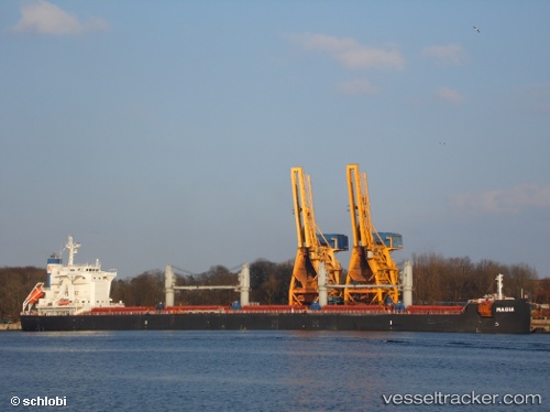
Vessel Magia IMO: 9710036, MMSI: 269041000 Bulk Carrier
UTC, 24.17687, 119.03741, course: 51, speed: 13.4
UTC, 24.48583, 119.43640, course: 40, speed: 14.4
2026-02-21 19:36:00 UTC, 24.81201, 119.74708, course: 44, speed: 14.9
Live AIS position:
UTC. 24 nm S of Damaiyu),
updated 2026-02-21 19:36:00 UTC.
Find the position of the vessel Magia on the map. The latter are known coordinates and path.
marine traffic ship tracker show on live map
The current position of vessel Magia is 24.81201 lat / 119.74708 lng. Updated: 2026-02-21 19:36:00 UTCDetails:
Last coordinates of the vessel:
UTC, 23.94706, 118.73602, course: 58, speed: 13.9UTC, 24.17687, 119.03741, course: 51, speed: 13.4
UTC, 24.48583, 119.43640, course: 40, speed: 14.4
2026-02-21 19:36:00 UTC, 24.81201, 119.74708, course: 44, speed: 14.9