 vesseltracker.com
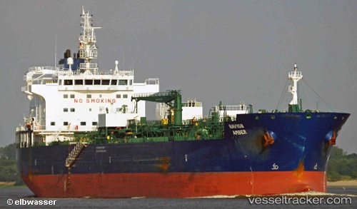
Vessel Navig8 Amber IMO: 9714056, MMSI: 538005771 Chemical Oil Products Tanker
UTC, 13.66833, -66.27167, course: -1, speed: 12
UTC, 13.48833, -65.90333, course: -1, speed: 12
2026-02-15 12:27:49 UTC, 13.28578, -65.48615, course: 114, speed: 12.1
Live AIS position:
UTC. 163 nm NW of Isla de Margarita),
updated 2026-02-15 12:27:49 UTC.
Find the position of the vessel Navig8 Amber on the map. The latter are known coordinates and path.
marine traffic ship tracker show on live map
The current position of vessel Navig8 Amber is 13.28578 lat / -65.48615 lng. Updated: 2026-02-15 12:27:49 UTCDetails:
Last coordinates of the vessel:
UTC, 13.93508, -66.82935, course: 113, speed: 12.3UTC, 13.66833, -66.27167, course: -1, speed: 12
UTC, 13.48833, -65.90333, course: -1, speed: 12
2026-02-15 12:27:49 UTC, 13.28578, -65.48615, course: 114, speed: 12.1