 vesseltracker.com
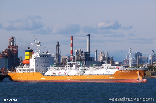
Vessel Gas Oceanroad IMO: 9715921, MMSI: 440037000 Lpg Tanker
UTC, 2.26144, 101.82032, course: 132, speed: 12.6
UTC, 1.96500, 102.14500, course: -1, speed: 11
2026-01-29 14:09:55 UTC, 1.76500, 102.50167, course: -1, speed: 11
Live AIS position:
UTC. 29 nm SE of Malacca),
updated 2026-01-29 14:09:55 UTC.
Find the position of the vessel Gas Oceanroad on the map. The latter are known coordinates and path.
marine traffic ship tracker show on live map
The current position of vessel Gas Oceanroad is 1.76500 lat / 102.50167 lng. Updated: 2026-01-29 14:09:55 UTCCurrently sailing under the flag of Korea
Details:
Last coordinates of the vessel:
UTC, 2.50820, 101.69634, course: 200, speed: 11.9UTC, 2.26144, 101.82032, course: 132, speed: 12.6
UTC, 1.96500, 102.14500, course: -1, speed: 11
2026-01-29 14:09:55 UTC, 1.76500, 102.50167, course: -1, speed: 11