 vesseltracker.com
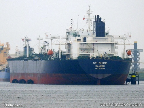
Vessel Sti Guide IMO: 9717113, MMSI: 538005823 Crude Oil Tanker
UTC, 29.73917, -95.12368, course: -1, speed: 0
UTC, 29.73759, -95.12332, course: 143, speed: 1.3
2026-02-26 08:22:09 UTC, 29.59071, -94.94017, course: 147, speed: 9.1
Live AIS position:
UTC. Near Shoreacres),
updated 2026-02-26 08:22:09 UTC.
Find the position of the vessel Sti Guide on the map. The latter are known coordinates and path.
marine traffic ship tracker show on live map
The current position of vessel Sti Guide is 29.59071 lat / -94.94017 lng. Updated: 2026-02-26 08:22:09 UTCDetails:
Last coordinates of the vessel:
UTC, 29.73916, -95.12368, course: -1, speed: 0UTC, 29.73917, -95.12368, course: -1, speed: 0
UTC, 29.73759, -95.12332, course: 143, speed: 1.3
2026-02-26 08:22:09 UTC, 29.59071, -94.94017, course: 147, speed: 9.1