 vesseltracker.com
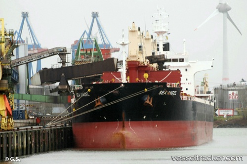
Vessel Sea Angel IMO: 9723942, MMSI: 538005945 Bulk Carrier
UTC, 38.64167, -12.34333, course: -1, speed: 10
UTC, 38.29833, -12.47333, course: -1, speed: 10
2026-02-17 16:30:03 UTC, 37.78500, -12.67500, course: -1, speed: 10
Live AIS position:
UTC. 111 nm W of Los Ramos),
updated 2026-02-17 16:30:03 UTC.
Find the position of the vessel Sea Angel on the map. The latter are known coordinates and path.
marine traffic ship tracker show on live map
The current position of vessel Sea Angel is 37.78500 lat / -12.67500 lng. Updated: 2026-02-17 16:30:03 UTCDetails:
Last coordinates of the vessel:
UTC, 38.92167, -12.26167, course: -1, speed: 10UTC, 38.64167, -12.34333, course: -1, speed: 10
UTC, 38.29833, -12.47333, course: -1, speed: 10
2026-02-17 16:30:03 UTC, 37.78500, -12.67500, course: -1, speed: 10