.
vessel Pink Sands IMO: 9724647, Bulk Carrier
vesseltracker.com
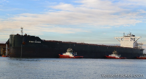
Vessel Pink Sands IMO: 9724647, MMSI: 249140000 Bulk Carrier

callsign: 9HA4125
size: 48x300

Live AIS position: UTC. Near TANAH MERAH), updated 2023-01-16 04:46:31 UTC.

Find the position of the vessel Pink Sands on the map. The latter are known coordinates and path.

marine traffic ship tracker show on live map

The current position of vessel Pink Sands is 1.28149 lat / 104.02544 lng. Updated: 2023-01-16 04:46:31 UTC
Details:


Last coordinates of the vessel:
2023-01-16 04:46:31 UTC, 1.28149, 104.02544, course: 54, speed: 0.2


Most frequent ports a vessels calls at Pink Sands (249140000):

Dagu, traffic: 4
Ta-Ku, traffic: 4
Selat Lombok, traffic: 3
Dagu Bar, traffic: 2
Sambu, traffic: 2
Dampier, traffic: 2
Singapore, traffic: 1
Taku Bar, traffic: 1

Link to the map:


Find another ship

Pink_Sands (249140000) last ports (portcalls and passsages)

Ta-Ku | 2023-01-04 06:27:37
Dagu Bar | 2022-09-07 16:21:22
Ta-Ku | 2022-09-07 01:35:47
Ta-Ku | 2022-09-03 01:06:39
Sambu | 2022-08-21 19:14:24
Ta-Ku | 2022-05-22 13:17:04
Taku Bar | 2022-05-22 10:17:07
Singapore | 2022-05-10 16:34:23
Selat Lombok | 2022-01-05 13:36:04
Dampier | 2021-12-30 14:31:06
Selat Lombok | 2021-12-20 02:59:14