 vesseltracker.com
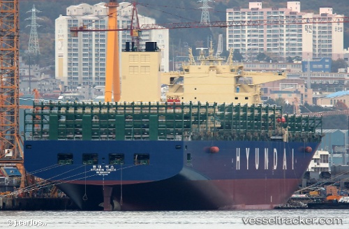
Vessel Hyundai Earth IMO: 9725110, MMSI: 232024772 Container Ship
UTC, 27.89575, 122.38568, course: 25, speed: 14.3
UTC, 28.13813, 122.52884, course: 28, speed: 13.8
2026-02-08 09:45:37 UTC, 28.52642, 122.79729, course: 20, speed: 10.9
Live AIS position:
UTC. 43 nm E of Wenling Longmen Port),
updated 2026-02-08 09:45:37 UTC.
Find the position of the vessel Hyundai Earth on the map. The latter are known coordinates and path.
marine traffic ship tracker show on live map
The current position of vessel Hyundai Earth is 28.52642 lat / 122.79729 lng. Updated: 2026-02-08 09:45:37 UTCCurrently sailing under the flag of United Kingdom
Details:
Last coordinates of the vessel:
UTC, 27.29518, 121.90586, course: 41, speed: 14.2UTC, 27.89575, 122.38568, course: 25, speed: 14.3
UTC, 28.13813, 122.52884, course: 28, speed: 13.8
2026-02-08 09:45:37 UTC, 28.52642, 122.79729, course: 20, speed: 10.9