 vesseltracker.com
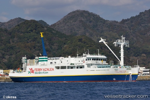
Vessel Ferry Azalea IMO: 9725689, MMSI: 431006033 Passenger Ro Ro Cargo Ship
UTC, 34.67050, 138.94922, course: 329, speed: 0
UTC, 34.67050, 138.94922, course: 329, speed: 0
2026-01-31 06:42:17 UTC, 34.67050, 138.94922, course: 329, speed: 0
Live AIS position:
UTC. Near Iruma),
updated 2026-01-31 06:42:17 UTC.
Find the position of the vessel Ferry Azalea on the map. The latter are known coordinates and path.
marine traffic ship tracker show on live map
The current position of vessel Ferry Azalea is 34.67050 lat / 138.94922 lng. Updated: 2026-01-31 06:42:17 UTCCurrently sailing under the flag of Japan
Details:
Last coordinates of the vessel:
UTC, 34.58841, 139.09360, course: 293, speed: 13.3UTC, 34.67050, 138.94922, course: 329, speed: 0
UTC, 34.67050, 138.94922, course: 329, speed: 0
2026-01-31 06:42:17 UTC, 34.67050, 138.94922, course: 329, speed: 0