 vesseltracker.com
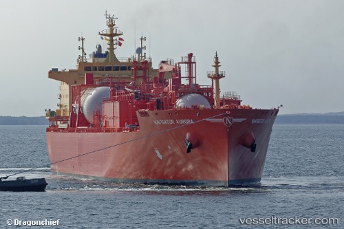
Vessel Navigator Aurora IMO: 9726322, MMSI: 636017409 Lpg Tanker
UTC, 38.59671, -65.34452, course: 70, speed: 12.5
UTC, 38.68368, -65.00430, course: 76, speed: 12.3
2026-02-16 07:31:45 UTC, 38.78512, -64.54201, course: 73, speed: 12.9
Live AIS position:
UTC. 284 nm S of CLARK'S HARBOUR),
updated 2026-02-16 07:31:45 UTC.
Find the position of the vessel Navigator Aurora on the map. The latter are known coordinates and path.
marine traffic ship tracker show on live map
The current position of vessel Navigator Aurora is 38.78512 lat / -64.54201 lng. Updated: 2026-02-16 07:31:45 UTCCurrently sailing under the flag of Liberia
Details:
Last coordinates of the vessel:
UTC, 38.46946, -65.85040, course: 69, speed: 13.4UTC, 38.59671, -65.34452, course: 70, speed: 12.5
UTC, 38.68368, -65.00430, course: 76, speed: 12.3
2026-02-16 07:31:45 UTC, 38.78512, -64.54201, course: 73, speed: 12.9