 vesseltracker.com
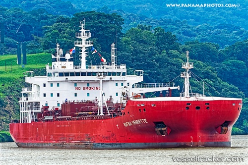
Vessel Hafnia Henriette IMO: 9726607, MMSI: 249345000 Chemical Oil Products Tanker
UTC, -6.84259, 39.29935, course: 149, speed: 0.1
UTC, -6.84261, 39.29943, course: 149, speed: 0
2026-02-18 01:20:28 UTC, -6.84257, 39.29942, course: 149, speed: 0
Live AIS position:
UTC. Near Kurasini),
updated 2026-02-18 01:20:28 UTC.
Find the position of the vessel Hafnia Henriette on the map. The latter are known coordinates and path.
marine traffic ship tracker show on live map
The current position of vessel Hafnia Henriette is -6.84257 lat / 39.29942 lng. Updated: 2026-02-18 01:20:28 UTCDetails:
Last coordinates of the vessel:
UTC, -6.84278, 39.29924, course: 149, speed: 0.1UTC, -6.84259, 39.29935, course: 149, speed: 0.1
UTC, -6.84261, 39.29943, course: 149, speed: 0
2026-02-18 01:20:28 UTC, -6.84257, 39.29942, course: 149, speed: 0