 vesseltracker.com
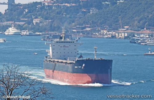
Vessel Ocean Saga IMO: 9729312, MMSI: 636018585 Bulk Carrier
UTC, -33.66572, 7.95178, course: 277, speed: 11.3
UTC, -33.63167, 7.66833, course: -1, speed: 11
2026-02-13 13:48:51 UTC, -33.58127, 7.14136, course: 277, speed: 11.3
Live AIS position:
UTC. Open sea, approx. 455 nm off the nearest listed port),
updated 2026-02-13 13:48:51 UTC.
Find the position of the vessel Ocean Saga on the map. The latter are known coordinates and path.
marine traffic ship tracker show on live map
The current position of vessel Ocean Saga is -33.58127 lat / 7.14136 lng. Updated: 2026-02-13 13:48:51 UTCDetails:
Last coordinates of the vessel:
UTC, -33.72667, 8.57500, course: -1, speed: 11UTC, -33.66572, 7.95178, course: 277, speed: 11.3
UTC, -33.63167, 7.66833, course: -1, speed: 11
2026-02-13 13:48:51 UTC, -33.58127, 7.14136, course: 277, speed: 11.3