 vesseltracker.com
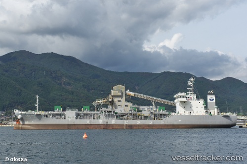
Vessel Pacific Glory IMO: 9739111, MMSI: 431006614 Cement Carrier
UTC, 38.59565, 141.71320, course: 188, speed: 11.6
UTC, 38.40639, 141.66028, course: 192, speed: 11.5
2026-02-01 11:32:07 UTC, 38.02645, 141.52249, course: 192, speed: 11.5
Live AIS position:
UTC. 25 nm S of ONAGAWA),
updated 2026-02-01 11:32:07 UTC.
Find the position of the vessel Pacific Glory on the map. The latter are known coordinates and path.
marine traffic ship tracker show on live map
The current position of vessel Pacific Glory is 38.02645 lat / 141.52249 lng. Updated: 2026-02-01 11:32:07 UTCDetails:
Last coordinates of the vessel:
UTC, 39.06905, 141.73123, course: 349, speed: 0UTC, 38.59565, 141.71320, course: 188, speed: 11.6
UTC, 38.40639, 141.66028, course: 192, speed: 11.5
2026-02-01 11:32:07 UTC, 38.02645, 141.52249, course: 192, speed: 11.5