 vesseltracker.com
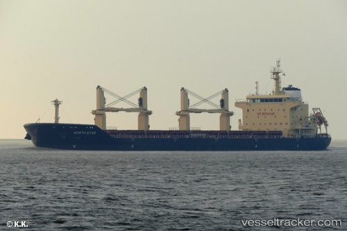
Vessel Merel D IMO: 9740433, MMSI: 215138000 Bulk Carrier
UTC, 13.8033, -144.363, course: -1, speed: 10
UTC, 13.7667, -144.132, course: -1, speed: 11
2026-03-01 05:58:51 UTC, 13.6951, -143.711, course: 97, speed: 11
Live AIS position:
UTC. 59 nm E of Santa Rita),
updated 2026-03-01 05:58:51 UTC.
Find the position of the vessel Merel D on the map. The latter are known coordinates and path.
marine traffic ship tracker show on live map
The current position of vessel Merel D is 13.6951 lat / -143.711 lng. Updated: 2026-03-01 05:58:51 UTCCurrently sailing under the flag of Malta
Details:
Last coordinates of the vessel:
UTC, 13.8704, -144.775, course: 95, speed: 10.2UTC, 13.8033, -144.363, course: -1, speed: 10
UTC, 13.7667, -144.132, course: -1, speed: 11
2026-03-01 05:58:51 UTC, 13.6951, -143.711, course: 97, speed: 11