 vesseltracker.com
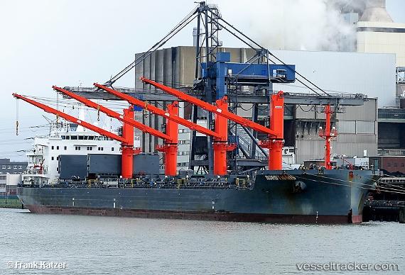
Vessel Nordtigris IMO: 9741700, MMSI: 255806049 Bulk Carrier
UTC, 54.44667, -168.12666, course: -1, speed: 8
UTC, 54.42963, -168.77876, course: 259, speed: 8.4
2026-02-13 13:36:52 UTC, 54.39667, -169.14000, course: -1, speed: 8
Live AIS position:
UTC. 98 nm W of Dutch Harbor),
updated 2026-02-13 13:36:52 UTC.
Find the position of the vessel Nordtigris on the map. The latter are known coordinates and path.
marine traffic ship tracker show on live map
The current position of vessel Nordtigris is 54.39667 lat / -169.14000 lng. Updated: 2026-02-13 13:36:52 UTCCurrently sailing under the flag of Portugal
Details:
Last coordinates of the vessel:
UTC, 54.44052, -167.81438, course: 268, speed: 8.4UTC, 54.44667, -168.12666, course: -1, speed: 8
UTC, 54.42963, -168.77876, course: 259, speed: 8.4
2026-02-13 13:36:52 UTC, 54.39667, -169.14000, course: -1, speed: 8