 vesseltracker.com
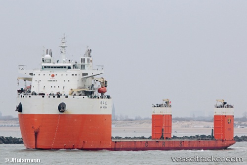
Vessel Hua Yang Long IMO: 9743710, MMSI: 414225000 Heavy Load Carrier
UTC, 27.40820, -15.65433, course: 136, speed: 2.1
UTC, 27.35951, -15.70038, course: 148, speed: 3.4
2026-02-11 00:12:24 UTC, 27.43361, -15.60219, course: 42, speed: 3.4
Live AIS position:
UTC. 19 nm S of PASITO BLANCO),
updated 2026-02-11 00:12:24 UTC.
Find the position of the vessel Hua Yang Long on the map. The latter are known coordinates and path.
marine traffic ship tracker show on live map
The current position of vessel Hua Yang Long is 27.43361 lat / -15.60219 lng. Updated: 2026-02-11 00:12:24 UTCCurrently sailing under the flag of China
Details:
Last coordinates of the vessel:
UTC, 27.46142, -15.60071, course: 137, speed: 2.4UTC, 27.40820, -15.65433, course: 136, speed: 2.1
UTC, 27.35951, -15.70038, course: 148, speed: 3.4
2026-02-11 00:12:24 UTC, 27.43361, -15.60219, course: 42, speed: 3.4