 vesseltracker.com
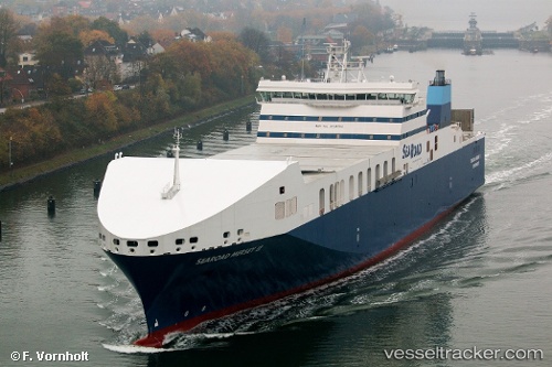
Vessel Searoad Mersey 2 IMO: 9745794, MMSI: 503000108 Container Ro Ro Cargo Ship
UTC, -39.21438, 145.11826, course: 165, speed: 19.8
UTC, -39.94500, 145.61166, course: -1, speed: 20
2026-02-17 16:14:08 UTC, -40.47097, 145.94669, course: 156, speed: 20.1
Live AIS position:
UTC. 34 nm NE of PORT LATTA),
updated 2026-02-17 16:14:08 UTC.
Find the position of the vessel Searoad Mersey 2 on the map. The latter are known coordinates and path.
marine traffic ship tracker show on live map
The current position of vessel Searoad Mersey 2 is -40.47097 lat / 145.94669 lng. Updated: 2026-02-17 16:14:08 UTCCurrently sailing under the flag of Australia
Details:
Last coordinates of the vessel:
UTC, -38.70990, 144.76363, course: 171, speed: 19.5UTC, -39.21438, 145.11826, course: 165, speed: 19.8
UTC, -39.94500, 145.61166, course: -1, speed: 20
2026-02-17 16:14:08 UTC, -40.47097, 145.94669, course: 156, speed: 20.1