 vesseltracker.com
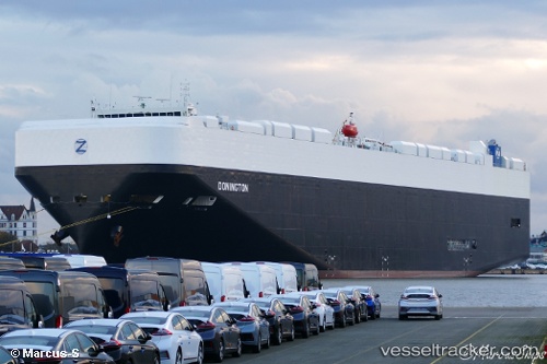
Vessel Donington IMO: 9748291, MMSI: 636017870 Vehicles Carrier
UTC, 29.96305, -78.03648, course: 202, speed: 18.2
UTC, 29.39208, -78.32322, course: 206, speed: 19.3
2026-02-21 20:15:01 UTC, 28.83889, -78.60269, course: 203, speed: 18.5
Live AIS position:
UTC. 109 nm E of Port Canaveral),
updated 2026-02-21 20:15:01 UTC.
Find the position of the vessel Donington on the map. The latter are known coordinates and path.
marine traffic ship tracker show on live map
The current position of vessel Donington is 28.83889 lat / -78.60269 lng. Updated: 2026-02-21 20:15:01 UTCCurrently sailing under the flag of Liberia
Details:
Last coordinates of the vessel:
UTC, 30.64794, -77.66210, course: 206, speed: 19.7UTC, 29.96305, -78.03648, course: 202, speed: 18.2
UTC, 29.39208, -78.32322, course: 206, speed: 19.3
2026-02-21 20:15:01 UTC, 28.83889, -78.60269, course: 203, speed: 18.5