 vesseltracker.com
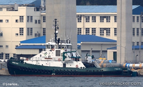
Vessel Michele Foss IMO: 9748564, MMSI: 367657270 Tug
UTC, 41.57862, -70.90061, course: 241, speed: 0.1
UTC, 41.58187, -70.89388, course: 50, speed: 4
2026-01-31 11:39:54 UTC, 41.62462, -70.91445, course: 161, speed: 0.3
Live AIS position:
UTC. Near NEW BEDFORD),
updated 2026-01-31 11:39:54 UTC.
Find the position of the vessel Michele Foss on the map. The latter are known coordinates and path.
marine traffic ship tracker show on live map
The current position of vessel Michele Foss is 41.62462 lat / -70.91445 lng. Updated: 2026-01-31 11:39:54 UTCCurrently sailing under the flag of USA
Details:
Last coordinates of the vessel:
UTC, 41.57860, -70.90061, course: 241, speed: 0.2UTC, 41.57862, -70.90061, course: 241, speed: 0.1
UTC, 41.58187, -70.89388, course: 50, speed: 4
2026-01-31 11:39:54 UTC, 41.62462, -70.91445, course: 161, speed: 0.3