 vesseltracker.com
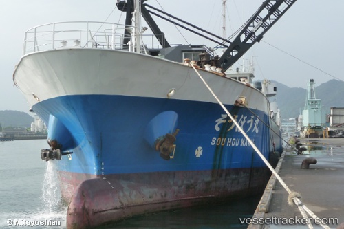
Vessel Souhou Maru IMO: 9759068, MMSI: 431005315 General Cargo Ship
UTC, 33.65500, 136.08333, course: -1, speed: 10
UTC, 33.86167, 136.30333, course: -1, speed: 10
2026-02-26 21:01:01 UTC, 34.02667, 136.54666, course: -1, speed: 11
Live AIS position:
UTC. 19 nm SW of HAMAJIMA),
updated 2026-02-26 21:01:01 UTC.
Find the position of the vessel Souhou Maru on the map. The latter are known coordinates and path.
marine traffic ship tracker show on live map
The current position of vessel Souhou Maru is 34.02667 lat / 136.54666 lng. Updated: 2026-02-26 21:01:01 UTCDetails:
Last coordinates of the vessel:
UTC, 33.46833, 135.57832, course: -1, speed: 10UTC, 33.65500, 136.08333, course: -1, speed: 10
UTC, 33.86167, 136.30333, course: -1, speed: 10
2026-02-26 21:01:01 UTC, 34.02667, 136.54666, course: -1, speed: 11