 vesseltracker.com
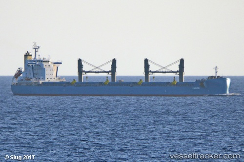
Vessel Pindos IMO: 9761322, MMSI: 314147000 Bulk Carrier
UTC, 15.15145, -57.17020, course: 123, speed: 10.3
UTC, 14.93322, -56.88992, course: 128, speed: 9.8
2026-01-29 23:59:36 UTC, 14.71706, -56.60751, course: 126, speed: 9.8
Live AIS position:
UTC. 191 nm NE of Sam Lords Castle),
updated 2026-01-29 23:59:36 UTC.
Find the position of the vessel Pindos on the map. The latter are known coordinates and path.
marine traffic ship tracker show on live map
The current position of vessel Pindos is 14.71706 lat / -56.60751 lng. Updated: 2026-01-29 23:59:36 UTCDetails:
Last coordinates of the vessel:
UTC, 15.29111, -57.35493, course: 92, speed: 3.2UTC, 15.15145, -57.17020, course: 123, speed: 10.3
UTC, 14.93322, -56.88992, course: 128, speed: 9.8
2026-01-29 23:59:36 UTC, 14.71706, -56.60751, course: 126, speed: 9.8