 vesseltracker.com
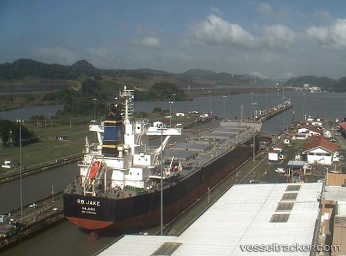
Vessel Rb Jake IMO: 9765706, MMSI: 538006443 Bulk Carrier
UTC, -25.75956, 48.82792, course: 60, speed: 11.2
UTC, -25.64743, 49.07117, course: 60, speed: 11.5
2026-02-23 04:20:19 UTC, -25.39134, 49.59119, course: 62, speed: 10.7
Live AIS position:
UTC. 142 nm E of Fort Dauphin),
updated 2026-02-23 04:20:19 UTC.
Find the position of the vessel Rb Jake on the map. The latter are known coordinates and path.
marine traffic ship tracker show on live map
The current position of vessel Rb Jake is -25.39134 lat / 49.59119 lng. Updated: 2026-02-23 04:20:19 UTCDetails:
Last coordinates of the vessel:
UTC, -25.93282, 48.43911, course: 63, speed: 11.3UTC, -25.75956, 48.82792, course: 60, speed: 11.2
UTC, -25.64743, 49.07117, course: 60, speed: 11.5
2026-02-23 04:20:19 UTC, -25.39134, 49.59119, course: 62, speed: 10.7