 vesseltracker.com
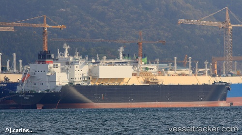
Vessel British Partner IMO: 9766530, MMSI: 232006301 Lng Tanker
UTC, -1.18845, 64.83102, course: 274, speed: 2
UTC, -1.22063, 64.76918, course: 265, speed: 1.5
2026-02-04 15:55:19 UTC, -1.24439, 64.72908, course: 263, speed: 1.3
Live AIS position:
UTC. 261 nm NE of Akpo),
updated 2026-02-04 15:55:19 UTC.
Find the position of the vessel British Partner on the map. The latter are known coordinates and path.
marine traffic ship tracker show on live map
The current position of vessel British Partner is -1.24439 lat / 64.72908 lng. Updated: 2026-02-04 15:55:19 UTCCurrently sailing under the flag of United Kingdom
Details:
Last coordinates of the vessel:
UTC, -1.16700, 64.88252, course: 284, speed: 2.7UTC, -1.18845, 64.83102, course: 274, speed: 2
UTC, -1.22063, 64.76918, course: 265, speed: 1.5
2026-02-04 15:55:19 UTC, -1.24439, 64.72908, course: 263, speed: 1.3