 vesseltracker.com
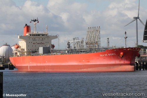
Vessel Isla De Bioko IMO: 9767235, MMSI: 374402000 Chemical Oil Products Tanker
UTC, 50.39192, 0.41996, course: 75, speed: 9.9
UTC, 50.54752, 1.08279, course: 50, speed: 8.8
2026-02-17 14:10:24 UTC, 50.71175, 1.36771, course: 28, speed: 8.4
Live AIS position:
UTC. Near Le Portel),
updated 2026-02-17 14:10:24 UTC.
Find the position of the vessel Isla De Bioko on the map. The latter are known coordinates and path.
marine traffic ship tracker show on live map
The current position of vessel Isla De Bioko is 50.71175 lat / 1.36771 lng. Updated: 2026-02-17 14:10:24 UTCCurrently sailing under the flag of Panama
Details:
Last coordinates of the vessel:
UTC, 50.30165, -0.04801, course: 74, speed: 11UTC, 50.39192, 0.41996, course: 75, speed: 9.9
UTC, 50.54752, 1.08279, course: 50, speed: 8.8
2026-02-17 14:10:24 UTC, 50.71175, 1.36771, course: 28, speed: 8.4