 vesseltracker.com
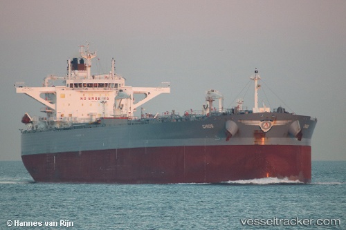
Vessel '241741000' IMO: 9772113, MMSI: 241741000
UTC, 33.90424, -118.45146, course: 270, speed: 0
UTC, 33.90325, -118.46945, course: 184, speed: 3.2
2026-01-29 22:06:59 UTC, 33.59833, -118.32317, course: 90, speed: 10.9
Live AIS position:
UTC. Near Rolling Hills),
updated 2026-01-29 22:06:59 UTC.
Find the position of the vessel '241741000' on the map. The latter are known coordinates and path.
marine traffic ship tracker show on live map
The current position of vessel '241741000' is 33.59833 lat / -118.32317 lng. Updated: 2026-01-29 22:06:59 UTCDetails:
Last coordinates of the vessel:
UTC, 33.90423, -118.45146, course: 270, speed: 0.1UTC, 33.90424, -118.45146, course: 270, speed: 0
UTC, 33.90325, -118.46945, course: 184, speed: 3.2
2026-01-29 22:06:59 UTC, 33.59833, -118.32317, course: 90, speed: 10.9