.
vessel Golden Ray IMO: 9775816, Vehicles Carrier
vesseltracker.com
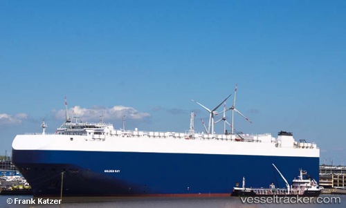
Vessel Golden Ray IMO: 9775816, MMSI: 538007762 Vehicles Carrier

callsign: V7MB9
size: 36x200

Live AIS position: UTC. 14 nm E of Port Bolivar), updated 2025-12-27 09:09:39 UTC.

Find the position of the vessel Golden Ray on the map. The latter are known coordinates and path.

marine traffic ship tracker show on live map

The current position of vessel Golden Ray is 29.30440 lat / -94.49420 lng. Updated: 2025-12-27 09:09:39 UTC
Details:


Last coordinates of the vessel:
2025-12-27 09:09:39 UTC, 29.30440, -94.49420, course: 178, speed: 0


Most frequent ports a vessels calls at Golden Ray (538007762):

Dagu Bar, traffic: 3
Dagu, traffic: 3
Ta-Ku, traffic: 3
Dumai, traffic: 2
Taku Bar, traffic: 1
Wu-Sung, traffic: 1
Wusong, traffic: 1
Antwerp, traffic: 1

Link to the map:


Find another ship

Golden_Ray (538007762) last ports (portcalls and passsages)

Wusong | 2024-04-02 12:58:57
Taku Bar | 2022-10-12 22:06:53
Dagu Bar | 2022-10-12 19:55:58
Ta-Ku | 2022-10-11 08:03:02
Dagu Bar | 2022-08-17 16:15:53
Ta-Ku | 2022-08-16 07:26:33
Ta-Ku | 2022-06-30 10:51:59
Dagu Bar | 2022-06-30 07:46:12
Antwerp | 2022-02-28 10:05:40
Dumai | 2022-01-12 20:39:06