 vesseltracker.com
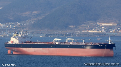
Vessel Matala IMO: 9776743, MMSI: 249862000 Crude Oil Tanker
UTC, 43.77654, 37.44320, course: 326, speed: 40.6
UTC, 43.77654, 37.44320, course: 326, speed: 40.6
2026-02-26 16:57:19 UTC, 43.77654, 37.44320, course: 326, speed: 40.6
Live AIS position:
UTC. 54 nm S of Cpc Terminal),
updated 2026-02-26 16:57:19 UTC.
Find the position of the vessel Matala on the map. The latter are known coordinates and path.
marine traffic ship tracker show on live map
The current position of vessel Matala is 43.77654 lat / 37.44320 lng. Updated: 2026-02-26 16:57:19 UTCDetails:
Last coordinates of the vessel:
UTC, 44.72172, 37.49815, course: 355, speed: 10.5UTC, 43.77654, 37.44320, course: 326, speed: 40.6
UTC, 43.77654, 37.44320, course: 326, speed: 40.6
2026-02-26 16:57:19 UTC, 43.77654, 37.44320, course: 326, speed: 40.6