 vesseltracker.com
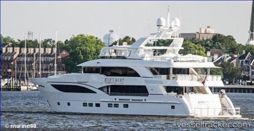
Vessel King Baby IMO: 9776901, MMSI: 319134600 Sailing Vessel
UTC, 18.03956, -63.09014, course: 165, speed: 0
UTC, 18.03956, -63.09014, course: 165, speed: 0
2026-01-27 16:30:33 UTC, 17.56089, -63.05875, course: 172, speed: 11.2
Live AIS position:
UTC. Near Oranjestad),
updated 2026-01-27 16:30:33 UTC.
Find the position of the vessel King Baby on the map. The latter are known coordinates and path.
marine traffic ship tracker show on live map
The current position of vessel King Baby is 17.56089 lat / -63.05875 lng. Updated: 2026-01-27 16:30:33 UTCDetails:
Last coordinates of the vessel:
UTC, 18.03956, -63.09012, course: 165, speed: 0UTC, 18.03956, -63.09014, course: 165, speed: 0
UTC, 18.03956, -63.09014, course: 165, speed: 0
2026-01-27 16:30:33 UTC, 17.56089, -63.05875, course: 172, speed: 11.2