 vesseltracker.com
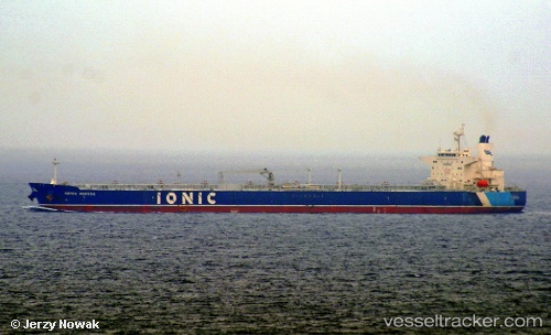
Vessel Ionic Anassa IMO: 9779795, MMSI: 538006696 Crude Oil Tanker
UTC, 10.76891, -65.56710, course: 127, speed: 12.1
UTC, 10.67400, -65.45574, course: 130, speed: 12.1
2026-01-20 05:39:32 UTC, 10.52198, -65.27722, course: 130, speed: 12.4
Live AIS position:
UTC. 30 nm NW of Puerto Piritu),
updated 2026-01-20 05:39:32 UTC.
Find the position of the vessel Ionic Anassa on the map. The latter are known coordinates and path.
marine traffic ship tracker show on live map
The current position of vessel Ionic Anassa is 10.52198 lat / -65.27722 lng. Updated: 2026-01-20 05:39:32 UTCDetails:
Last coordinates of the vessel:
UTC, 10.93167, -65.79332, course: 117, speed: 11.1UTC, 10.76891, -65.56710, course: 127, speed: 12.1
UTC, 10.67400, -65.45574, course: 130, speed: 12.1
2026-01-20 05:39:32 UTC, 10.52198, -65.27722, course: 130, speed: 12.4