 vesseltracker.com
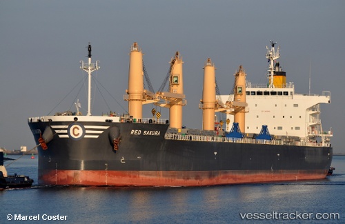
Vessel RED SAKURA IMO: 9781968, MMSI: 636022134 Bulk Carrier
UTC, 9.24789, -79.91777, course: 332, speed: 0.1
UTC, 9.24780, -79.91787, course: 335, speed: 0.1
2026-02-27 19:40:13 UTC, 9.26990, -79.92312, course: 8, speed: 0.1
Live AIS position:
UTC. Near Fuerte Davis),
updated 2026-02-27 19:40:13 UTC.
Find the position of the vessel RED SAKURA on the map. The latter are known coordinates and path.
marine traffic ship tracker show on live map
The current position of vessel RED SAKURA is 9.26990 lat / -79.92312 lng. Updated: 2026-02-27 19:40:13 UTCCurrently sailing under the flag of Liberia
RED SAKURA built in 2017 year
Deadweight:
60245 tDetails:
Last coordinates of the vessel:
UTC, 9.13404, -79.80783, course: 347, speed: 9.3UTC, 9.24789, -79.91777, course: 332, speed: 0.1
UTC, 9.24780, -79.91787, course: 335, speed: 0.1
2026-02-27 19:40:13 UTC, 9.26990, -79.92312, course: 8, speed: 0.1