 vesseltracker.com
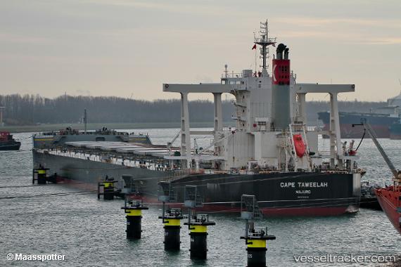
Vessel Cape Taweelah IMO: 9782302, MMSI: 538007226 Bulk Carrier
UTC, 26.16728, 50.78238, course: -1, speed: 0
UTC, 27.56280, 52.49536, course: 52, speed: 0.1
2026-02-28 17:45:25 UTC, 27.56281, 52.49539, course: 46, speed: 0
Live AIS position:
UTC. Near ASALUYEH),
updated 2026-02-28 17:45:25 UTC.
Find the position of the vessel Cape Taweelah on the map. The latter are known coordinates and path.
marine traffic ship tracker show on live map
The current position of vessel Cape Taweelah is 27.56281 lat / 52.49539 lng. Updated: 2026-02-28 17:45:25 UTCDetails:
Last coordinates of the vessel:
UTC, 26.16728, 50.78238, course: -1, speed: 0UTC, 26.16728, 50.78238, course: -1, speed: 0
UTC, 27.56280, 52.49536, course: 52, speed: 0.1
2026-02-28 17:45:25 UTC, 27.56281, 52.49539, course: 46, speed: 0