 vesseltracker.com
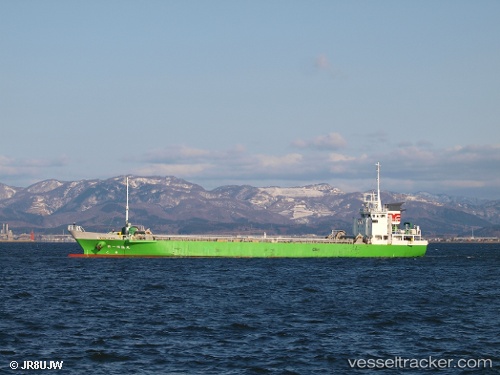
Vessel Meiryu Maru No.1 IMO: 9790488, MMSI: 431005772 General Cargo Ship
UTC, 34.01406, 132.62010, course: 60, speed: 9.8
UTC, 34.14993, 132.95312, course: 118, speed: 9.2
2026-02-16 16:26:06 UTC, 34.18967, 133.23045, course: 57, speed: 9.9
Live AIS position:
UTC. Near HAKATASHIMA),
updated 2026-02-16 16:26:06 UTC.
Find the position of the vessel Meiryu Maru No.1 on the map. The latter are known coordinates and path.
marine traffic ship tracker show on live map
The current position of vessel Meiryu Maru No.1 is 34.18967 lat / 133.23045 lng. Updated: 2026-02-16 16:26:06 UTCCurrently sailing under the flag of Japan
Details:
Last coordinates of the vessel:
UTC, 33.81337, 132.16235, course: 62, speed: 10.4UTC, 34.01406, 132.62010, course: 60, speed: 9.8
UTC, 34.14993, 132.95312, course: 118, speed: 9.2
2026-02-16 16:26:06 UTC, 34.18967, 133.23045, course: 57, speed: 9.9