 vesseltracker.com
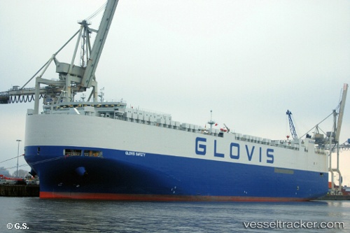
Vessel Glovis Safety IMO: 9798399, MMSI: 538007438 Vehicles Carrier
UTC, 31.51137, -13.93262, course: 195, speed: 17.8
UTC, 30.86055, -14.13545, course: 196, speed: 18.5
2026-01-20 05:53:06 UTC, 30.25220, -14.31947, course: 196, speed: 18.4
Live AIS position:
UTC. 75 nm NW of Caleta de Sebo),
updated 2026-01-20 05:53:06 UTC.
Find the position of the vessel Glovis Safety on the map. The latter are known coordinates and path.
marine traffic ship tracker show on live map
The current position of vessel Glovis Safety is 30.25220 lat / -14.31947 lng. Updated: 2026-01-20 05:53:06 UTCDetails:
Last coordinates of the vessel:
UTC, 31.85161, -13.82252, course: 196, speed: 17.9UTC, 31.51137, -13.93262, course: 195, speed: 17.8
UTC, 30.86055, -14.13545, course: 196, speed: 18.5
2026-01-20 05:53:06 UTC, 30.25220, -14.31947, course: 196, speed: 18.4