 vesseltracker.com
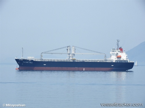
Vessel Pulang Tala IMO: 9798480, MMSI: 548971000 General Cargo Ship
UTC, 29.43500, 125.90167, course: -1, speed: 9
UTC, 29.87500, 126.13667, course: -1, speed: 10
2026-03-19 10:52:50 UTC, 29.96333, 126.20500, course: -1, speed: 10
Live Vessel Pulang Tala Analytics (details, animations, etc.)
Live AIS position: UTC. 193 nm E of Lü-hua Shan), updated 2026-03-19 10:52:50 UTC.Find the position of the vessel Pulang Tala on the map. The latter are known coordinates and path.
marine traffic ship tracker show on live map
The current position of vessel Pulang Tala is 29.96333 lat / 126.20500 lng. Updated: 2026-03-19 10:52:50 UTCCurrently sailing under the flag of Philippines
Details:
Last coordinates of the vessel:
UTC, 29.22953, 125.76054, course: -1, speed: 9.2UTC, 29.43500, 125.90167, course: -1, speed: 9
UTC, 29.87500, 126.13667, course: -1, speed: 10
2026-03-19 10:52:50 UTC, 29.96333, 126.20500, course: -1, speed: 10