 vesseltracker.com
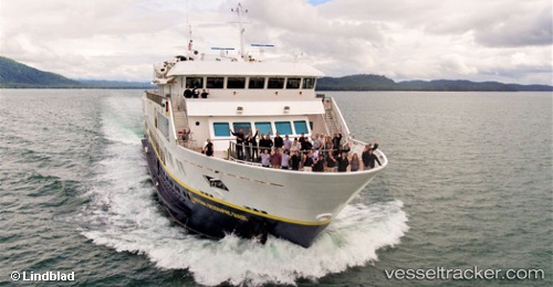
Vessel Nat Geo Quest IMO: 9798985, MMSI: 366945000 Cruise Ship
UTC, 7.62241, -81.71718, course: 350, speed: 2.3
UTC, 7.47333, -81.44500, course: -1, speed: 11
2026-02-27 19:37:29 UTC, 7.28658, -81.13474, course: 120, speed: 11.6
Live AIS position:
UTC. 14 nm W of El Puerto),
updated 2026-02-27 19:37:29 UTC.
Find the position of the vessel Nat Geo Quest on the map. The latter are known coordinates and path.
marine traffic ship tracker show on live map
The current position of vessel Nat Geo Quest is 7.28658 lat / -81.13474 lng. Updated: 2026-02-27 19:37:29 UTCDetails:
Last coordinates of the vessel:
UTC, 7.62159, -81.71715, course: 39, speed: 0UTC, 7.62241, -81.71718, course: 350, speed: 2.3
UTC, 7.47333, -81.44500, course: -1, speed: 11
2026-02-27 19:37:29 UTC, 7.28658, -81.13474, course: 120, speed: 11.6