 vesseltracker.com
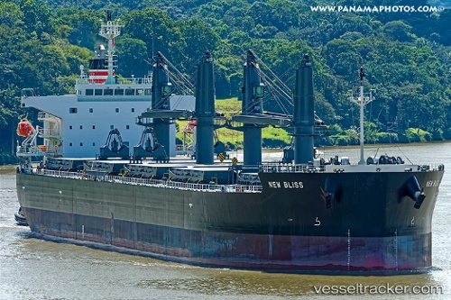
Vessel New Bliss IMO: 9799745, MMSI: 357074000 General Cargo Ship
UTC, 1.61767, -130.41431, course: 104, speed: 9.5
UTC, 1.52818, -130.10330, course: 105, speed: 10.9
2026-02-15 01:28:04 UTC, 1.46524, -129.88139, course: 106, speed: 11.2
Live AIS position:
UTC. 319 nm W of Amurang),
updated 2026-02-15 01:28:04 UTC.
Find the position of the vessel New Bliss on the map. The latter are known coordinates and path.
marine traffic ship tracker show on live map
The current position of vessel New Bliss is 1.46524 lat / -129.88139 lng. Updated: 2026-02-15 01:28:04 UTCDetails:
Last coordinates of the vessel:
UTC, 1.69302, -130.67450, course: 106, speed: 9.4UTC, 1.61767, -130.41431, course: 104, speed: 9.5
UTC, 1.52818, -130.10330, course: 105, speed: 10.9
2026-02-15 01:28:04 UTC, 1.46524, -129.88139, course: 106, speed: 11.2