 vesseltracker.com
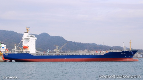
Vessel Estima IMO: 9808041, MMSI: 311000780 Container Ship
UTC, 31.01667, 123.08500, course: -1, speed: 0
UTC, 31.01667, 123.08500, course: -1, speed: 0
2026-02-12 05:50:21 UTC, 31.01857, 123.08554, course: 195, speed: 0.1
Live AIS position:
UTC. 27 nm NE of Lü-hua Shan),
updated 2026-02-12 05:50:21 UTC.
Find the position of the vessel Estima on the map. The latter are known coordinates and path.
marine traffic ship tracker show on live map
The current position of vessel Estima is 31.01857 lat / 123.08554 lng. Updated: 2026-02-12 05:50:21 UTCCurrently sailing under the flag of Bahamas
Details:
Last coordinates of the vessel:
UTC, 31.01797, 123.08444, course: 119, speed: 0.1UTC, 31.01667, 123.08500, course: -1, speed: 0
UTC, 31.01667, 123.08500, course: -1, speed: 0
2026-02-12 05:50:21 UTC, 31.01857, 123.08554, course: 195, speed: 0.1