 vesseltracker.com
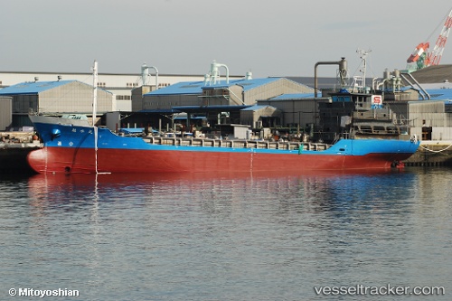
Vessel Kakusui Maru IMO: 9809289, MMSI: 431009016 Chemical Tanker
UTC, 33.66167, 135.28833, course: -1, speed: 11
UTC, 33.94471, 135.04111, course: 1, speed: 12
2026-02-09 18:13:46 UTC, 34.32288, 135.02603, course: 44, speed: 11.5
Live AIS position:
UTC. Near KADA),
updated 2026-02-09 18:13:46 UTC.
Find the position of the vessel Kakusui Maru on the map. The latter are known coordinates and path.
marine traffic ship tracker show on live map
The current position of vessel Kakusui Maru is 34.32288 lat / 135.02603 lng. Updated: 2026-02-09 18:13:46 UTCCurrently sailing under the flag of Japan
Details:
Last coordinates of the vessel:
UTC, 33.46167, 135.62833, course: -1, speed: 11UTC, 33.66167, 135.28833, course: -1, speed: 11
UTC, 33.94471, 135.04111, course: 1, speed: 12
2026-02-09 18:13:46 UTC, 34.32288, 135.02603, course: 44, speed: 11.5