 vesseltracker.com
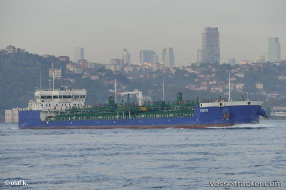
Vessel GANJA IMO: 9813565, MMSI: 352003383 Tanker
UTC, 40.95524, 28.74332, course: -1, speed: 0
UTC, 40.95542, 28.74298, course: 36, speed: 0.1
2026-02-26 09:24:59 UTC, 40.95540, 28.74318, course: 27, speed: 0.1
Live AIS position:
UTC. Near Küçükçekmece),
updated 2026-02-26 09:24:59 UTC.
Find the position of the vessel GANJA on the map. The latter are known coordinates and path.
marine traffic ship tracker show on live map
The current position of vessel GANJA is 40.95540 lat / 28.74318 lng. Updated: 2026-02-26 09:24:59 UTCCurrently sailing under the flag of Panama
Details:
Last coordinates of the vessel:
UTC, 40.95517, 28.74370, course: 17, speed: 0.1UTC, 40.95524, 28.74332, course: -1, speed: 0
UTC, 40.95542, 28.74298, course: 36, speed: 0.1
2026-02-26 09:24:59 UTC, 40.95540, 28.74318, course: 27, speed: 0.1