 vesseltracker.com
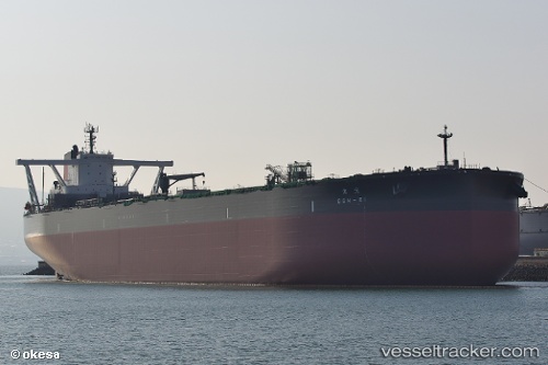
Vessel Gen ei IMO: 9814117, MMSI: 431877000 Crude Oil Tanker
UTC, 29.13333, 130.00166, course: -1, speed: 13
UTC, 29.32833, 130.37334, course: -1, speed: 13
2026-02-13 20:03:20 UTC, 29.60594, 130.83859, course: 56, speed: 14.1
Live AIS position:
UTC. 68 nm S of NISHINOOMOTE),
updated 2026-02-13 20:03:20 UTC.
Find the position of the vessel Gen ei on the map. The latter are known coordinates and path.
marine traffic ship tracker show on live map
The current position of vessel Gen ei is 29.60594 lat / 130.83859 lng. Updated: 2026-02-13 20:03:20 UTCDetails:
Last coordinates of the vessel:
UTC, 28.85500, 129.47833, course: -1, speed: 13UTC, 29.13333, 130.00166, course: -1, speed: 13
UTC, 29.32833, 130.37334, course: -1, speed: 13
2026-02-13 20:03:20 UTC, 29.60594, 130.83859, course: 56, speed: 14.1