 vesseltracker.com
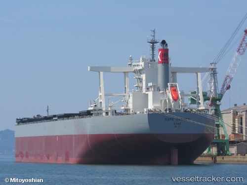
Vessel Cape Garnet IMO: 9820867, MMSI: 431664000 Bulk Carrier
UTC, -30.24830, 153.59808, course: 192, speed: 16.9
UTC, -30.89653, 153.41507, course: 193, speed: 16.8
2026-02-25 15:45:58 UTC, -31.39042, 153.27341, course: 195, speed: 17.7
Live AIS position:
UTC. 19 nm E of PORT MACQUARIE),
updated 2026-02-25 15:45:58 UTC.
Find the position of the vessel Cape Garnet on the map. The latter are known coordinates and path.
marine traffic ship tracker show on live map
The current position of vessel Cape Garnet is -31.39042 lat / 153.27341 lng. Updated: 2026-02-25 15:45:58 UTCCurrently sailing under the flag of Japan
Details:
Last coordinates of the vessel:
UTC, -29.80685, 153.72520, course: 192, speed: 16UTC, -30.24830, 153.59808, course: 192, speed: 16.9
UTC, -30.89653, 153.41507, course: 193, speed: 16.8
2026-02-25 15:45:58 UTC, -31.39042, 153.27341, course: 195, speed: 17.7