 vesseltracker.com
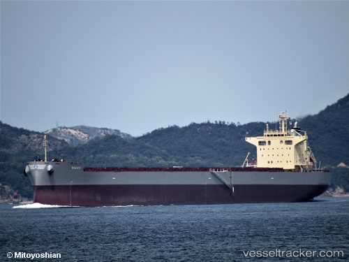
Vessel Balos IMO: 9825532, MMSI: 311000802 Bulk Carrier
UTC, -17.08649, 65.27828, course: 240, speed: 12.3
UTC, -17.31189, 64.72608, course: 246, speed: 12.5
2026-02-12 17:58:04 UTC, -17.44225, 64.41286, course: 246, speed: 12.4
Live AIS position:
UTC. 146 nm NE of Port Mathurin),
updated 2026-02-12 17:58:04 UTC.
Find the position of the vessel Balos on the map. The latter are known coordinates and path.
marine traffic ship tracker show on live map
The current position of vessel Balos is -17.44225 lat / 64.41286 lng. Updated: 2026-02-12 17:58:04 UTCDetails:
Last coordinates of the vessel:
UTC, -16.89445, 65.73921, course: 245, speed: 12.4UTC, -17.08649, 65.27828, course: 240, speed: 12.3
UTC, -17.31189, 64.72608, course: 246, speed: 12.5
2026-02-12 17:58:04 UTC, -17.44225, 64.41286, course: 246, speed: 12.4